
Scenic road · Kranjska Gora
Vršič Pass
Slovenia’s highest road pass at 1,611 m, fifty numbered hairpins, twenty-four of them cobbled.
- Highly rated


Language
Language

Archaeological site
Photo: Luka Škerjanec · CC BY-SA 4.0
Ajdna is a peak in the Karawanks in the Municipality of Žirovnica in the Upper Carniola region of Slovenia. Access to it is easiest from the village of Potoki in the neighbouring Municipality of Jesenice.
Wikipedia · CC BY-SA 4.0
Ajdna combines a steep mountain setting and broad views over the Upper Sava Valley with the remains of a late-antique settlement, including an early Christian church and houses partly cut into the rock.
On the rocky summit terraces, look for the conserved remains of the church and some of the settlement’s roughly 25 buildings. The church had spaces for worshippers and clergy, an entrance porch and a later annex that may have served as a baptistery. From the summit, the view takes in the Upper Sava Valley, Bled, Mežakla, the Julian Alps and Stol.
Ajdna was a defended refuge for people from the valley during the upheavals and migrations of the 5th and 6th centuries, after the Roman Empire’s collapse. The settlement was abandoned by the end of the 6th century, then occupied again in the 9th. Excavations began in 1973, and the site is a monument of national significance. Sts. Ingenuin and Albuin Church is 2.4 km away.
Wikidata · Wikipedia (sl) · Wikipedia (en) · CC BY-SA 4.0
We have no accessibility data for this place. That does not mean it is inaccessible, please contact them directly.
Scenic road · Kranjska Gora
Slovenia’s highest road pass at 1,611 m, fifty numbered hairpins, twenty-four of them cobbled.

Lake · Bohinj
Slovenia’s largest natural lake, 4.2 km long, inside Triglav National Park, and genuinely swimmable.

Gorge · Bled
A 1.6 km boardwalk pinned to the wall of a limestone gorge cut by the Radovna, ending at the Šum waterfall.
Restaurant · Radovljica
A manor-house restaurant near Radovljica cooking modern Slovenian food from its own garden, ten minutes from Bled.
Restaurant · Bohinj
A village restaurant in Stara Fužina serving Bohinj valley cooking, and the štruklji it is named after.
Restaurant · Radovljica
A traditional inn on Radovljica’s medieval square with a working honey-bread workshop in the cellar.

Archaeological site · Idrija
Divje Babe is a karst cave and archaeological park overlooking the Idrijca River in northwestern Slovenia. It is noted for its Paleolithic remains, including the worked bone of cave bear known as the Divje Babe Flute, which has controversially been interpreted as a Neanderthal musical instrument.· Wikipedia

Archaeological site · Logarska Dolina
Potok Cave is a cave in northern Slovenia, declared a high-elevation archaeological and paleontological site, occupied approximately 35,000 years BP by anatomically modern humans of the Aurignacian culture during the Upper Paleolithic. The cave is named after the Potok Farm in Podolševa.· Wikipedia
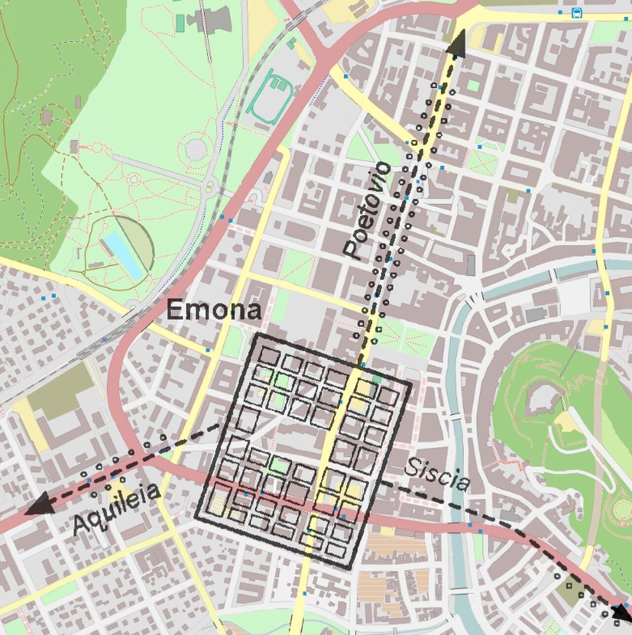
Archaeological site · Ljubljana
Emona was a Roman castrum, located in the area where the navigable Nauportus River came closest to Castle Hill, serving the trade between the city's settlers – colonists from the northern part of Roman Italy – and the rest of the empire.· Wikipedia

Archaeological site · Vipava Valley
Castra ad Fluvium Frigidum, also simply Castra, referred to as mutatio Castra in Itinerarium Burdigalense, was a Late-Roman fortress (castrum) which constituted the centre of Claustra Alpium Iuliarum, an Ancient Roman defensive system of walls and towers stretching from the Gail Valley to the Učka mountain range.· Wikipedia